Reading weather signs on a mountain ridge requires learning to interpret clouds, wind patterns, and pressure changes that occur at elevation—skills that transform raw observation into reliable forecasting. You can develop this ability by training your eye to recognize specific cloud formations, monitoring wind direction and intensity, and understanding how these elements combine to signal what weather is approaching. For example, when a hiker on a ridge notices cirrus clouds increasing in number and beginning to cover the sky, they’re observing a sign that rain will likely arrive within 24 hours, giving them time to descend or prepare. This practical knowledge has kept mountaineers safe for centuries and remains one of the most accessible weather tools available in the backcountry.
The skill lies not in complex meteorology, but in learning which signs matter and what they mean. Mountain ridges provide an ideal vantage point for this observation because you’re elevated above valleys, closer to weather systems, and surrounded by clear sight lines in all directions. Unlike lowland areas where terrain blocks visibility, a ridge position offers continuous visibility of cloud development, wind shifts, and atmospheric changes. Once you understand the basic patterns—which cloud types bring rain, which wind directions bring stability, how pressure translates to altitude readings—you can make decisions about whether to continue climbing, descend, or wait out a weather window.
Table of Contents
- What Do Cloud Formations Tell You About Approaching Weather?
- How Wind Direction and Shifts Reveal Pressure Changes
- Visual Indicators Beyond Clouds That Signal Weather Changes
- How to Interpret Pressure Changes and Use an Altimeter
- Common Mistakes in Reading Mountain Ridge Weather Signs
- Using Instruments and Tools to Verify Your Observations
- Integrating Weather Sign Reading Into Ridge Safety Planning
- Conclusion
What Do Cloud Formations Tell You About Approaching Weather?
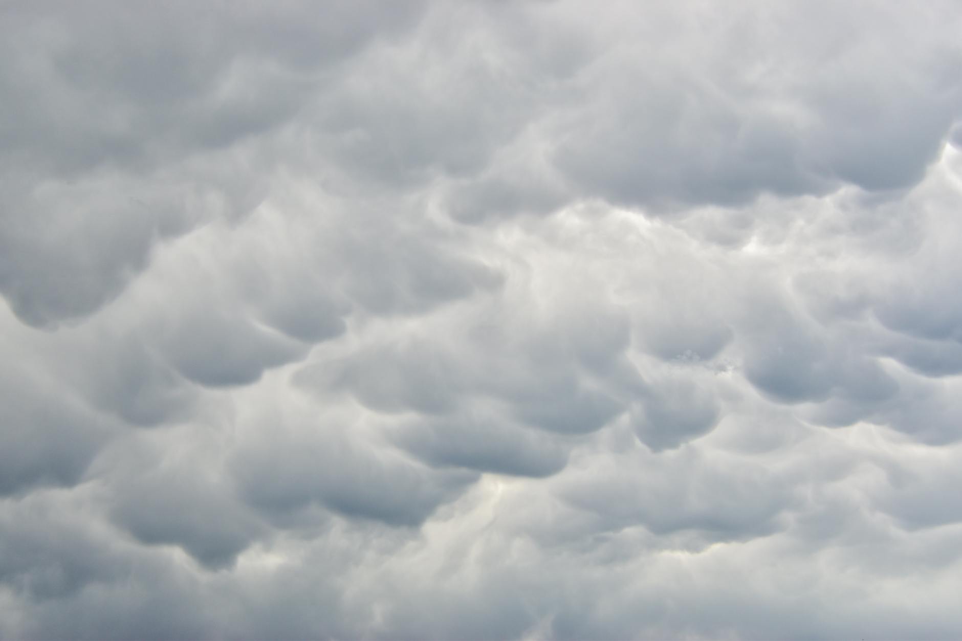
Cloud formations are the primary indicator of coming weather changes on a ridge, and each type carries specific information if you know what to look for. Cirrus clouds—those thin, wispy formations at the highest elevations—signal weather shifts. When just a few cirrus clouds appear, fair weather typically continues. But when they begin to multiply and spread across the sky, they indicate a weather system is approaching, with rain likely to arrive within 24 hours. This transition from scattered to dense cirrus coverage is one of the most reliable warning signs available to mountain observers. The clouds are forming as warm, moist air moves ahead of a weather system, and their increasing presence acts as a bellwether for what’s coming. Lenticular clouds—the distinctive lens-shaped formations that hover over peaks like stationary spacecraft—provide another critical signal.
These clouds form when stable, moisture-laden air flows over the ridge, and their appearance indicates strengthening winds and sufficient atmospheric moisture for storm development. When you observe a lenticular cloud cap forming or expanding on the ridge, expect conditions to deteriorate within 6 to 18 hours as an organized weather system approaches. Large, towering cumulus clouds on a summer morning present an equally important warning sign: they suggest that heavy rain and thunderstorms may develop later in the same day as solar heating amplifies instability. The vertical development of these clouds is essentially the atmosphere’s way of signaling that energy is building. Cirrostratus clouds create halos around the sun or moon due to ice crystal refraction, and this phenomenon has been recognized as a weather sign for generations. When you observe a clear ring around the sun or moon on a ridge, know that moisture-laden air is present in the atmosphere above you, and rain or snow will likely approach within 72 hours. This particular sign is valuable because it works at any time of day or night and provides a clear visual threshold—you either see the halo or you don’t. The timing window of up to 72 hours gives you more lead time than some other indicators, allowing for more deliberate planning about whether to retreat to lower elevations.
How Wind Direction and Shifts Reveal Pressure Changes
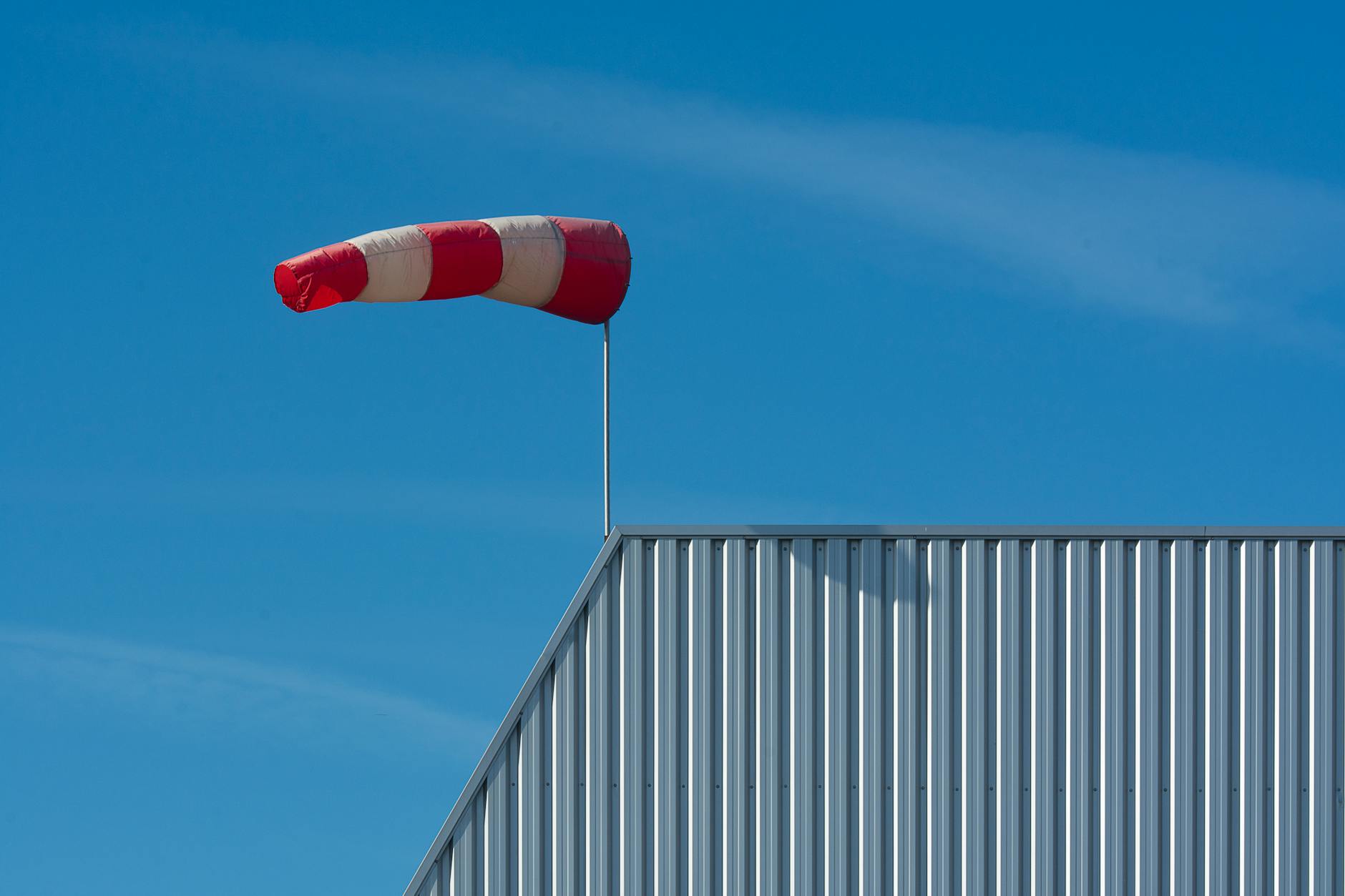
Wind direction on a ridge is more than just a comfort concern—it’s a fundamental indicator of pressure patterns and weather stability. Easterly winds typically bring stable, fair weather conditions because they’re associated with high pressure systems. Conversely, westerly winds bring changeable, wet weather with a genuine risk of thunderstorms. This directional rule holds true across many regions and has been validated by both meteorological science and extensive anecdotal evidence from mountain users. The direction of the wind is determined by the pressure gradient—where the air is flowing from high pressure toward low pressure—so observing wind direction essentially allows you to infer the larger pressure patterns you can’t directly see. Wind shifts and strengthening present another critical warning sign that many ridge observers overlook until they experience a dangerous situation. When winds are calm or stable, the weather system overhead is likely stable as well, and you can make longer-term plans for your ridge exposure. However, when winds begin to shift direction unpredictably or strengthen significantly, a weather system is approaching and conditions are about to change.
Strong, shifting winds often precede storm arrival by just a few hours, so this sign has urgency. Additionally, if you observe that cirrus clouds are moving from right to left across your field of vision, a low-pressure system is approaching and weather will deteriorate. If clouds move left to right, you’re in improving conditions and pressure is rising. This cloud-motion observation combined with wind observation creates a more complete picture of your situation. The limitation of relying on wind direction alone is that wind can be funneled by terrain, creating local anomalies that don’t reflect the broader weather pattern. A ridge aligned with a particular direction can funnel wind from one direction regardless of the actual pressure pattern overhead. This is why experienced ridge observers combine wind direction information with cloud observations—using one source to verify the other. In valleys, wind direction may be completely reversed from what the large-scale pattern would predict. On an exposed ridge, this terrain funneling effect is less pronounced, but it can still occur, particularly in mountain ranges with very consistent ridgeline orientation.
Visual Indicators Beyond Clouds That Signal Weather Changes
Beyond clouds, several visual cues provide immediate feedback about atmospheric conditions and moisture content. A sharp, well-defined cloud base—where you can clearly see the distinct boundary between cloud and clear air—indicates that precipitation is not imminent. Conversely, a blurry, indistinct cloud base suggests that precipitation is already beginning or will begin soon, because the precipitation itself is blurring the boundary between cloud and air. This distinction is particularly valuable on a ridge because you’re observing clouds from a vantage point where you can see their detail and structure clearly. The visual sharpness of the boundary literally reflects the density of water droplets and ice crystals, and high density means precipitation is near. A lenticular cap or “hat” on a mountain ridge—a specific formation of lenticular clouds directly over the peak—actually indicates stable weather conditions with light winds, contrary to what might seem intuitive.
While lenticular clouds themselves indicate moisture and wind, a stable lenticular cap that hovers over the ridge without growing or changing shape suggests that the strongest winds are occurring above the ridgeline but the ridge itself is in a relatively protected, stable pocket. This is a subtle but important distinction for ridge users, because it means you can remain on the ridge longer than you might otherwise expect. Once the lenticular cap begins to distort, grow downwind, or dissipate, conditions are beginning to change and you should prepare to descend. The presence of a ring around the sun or moon—formed by cirrostratus clouds with ice crystals at high altitude—combines the visual indicator of the halo with the timing indicator of 72 hours before precipitation. This sign is particularly useful on ridges at high elevation, where you’re actually below the ice crystal layer and can observe it from a unique vantage point. On lower-elevation ridges or in valleys, the high-altitude ice crystals may not produce a visible halo even though they’re present. This is another example of how your ridge position gives you information that valley observers lack.
How to Interpret Pressure Changes and Use an Altimeter
Barometric pressure is the fundamental driver of weather systems, and observing pressure changes gives you the most direct information about what weather is approaching. Falling barometric pressure signals an approaching storm, with rapid drops serving as critical warnings that conditions will deteriorate soon. However, most ridge climbers don’t carry a barometer, so they must infer pressure changes from other observations or use a pocket altimeter in an unconventional way. A pocket altimeter indicates elevation by measuring atmospheric pressure—when air pressure is higher, the instrument reads a lower elevation, and vice versa. This means if you note your exact elevation and then later observe that your altimeter shows you’ve gained elevation when you actually haven’t moved, the reading is revealing that air pressure has fallen, which is a sign of approaching bad weather. This altimeter technique has practical value because many climbers already carry altimeters for navigation and elevation gain tracking. By checking your altimeter periodically throughout the day while remaining at the same location, you can create a pressure trend.
If the altimeter reading creeps upward (indicating pressure is falling), weather is likely approaching. If the reading stays stable or drifts downward (indicating pressure is rising or stable), conditions are likely stable. The limitation of this method is that it requires multiple readings over time and a clear baseline, so it’s not an immediate warning like cloud observation. However, combined with cloud observation, it provides confirmation of what the clouds are already suggesting. Rapid drops in barometric pressure are particularly critical warnings because they indicate a strong weather system is moving in quickly. Slow, gradual pressure declines may precede weather by 24 to 48 hours, giving you time to make a careful descent or prepare. Rapid drops, observed over just a few hours, can mean that a thunderstorm or severe system will arrive within hours, demanding immediate action. This is why many ridge guides and mountaineers place high value on barometric pressure monitoring—it’s the most direct measure of what the weather system is actually doing, rather than an indicator of what it might do.
Common Mistakes in Reading Mountain Ridge Weather Signs
One significant mistake is assuming that a beautiful, clear morning means the weather is stable for the entire day. A summer ridge can be perfectly clear at dawn, with cirrus clouds completely absent and wind calm. But by late morning, solar heating can build instability that creates heavy cumulus clouds by afternoon, with thunderstorms developing by late afternoon. This daily cycle is so predictable in certain seasons that the presence of a clear morning should actually prompt caution, because you know the day will warm. Experienced ridge users may descend early specifically because of a clear morning, understanding that afternoon weather is likely to deteriorate. The lesson is that current conditions don’t predict afternoon conditions—cloud evolution and wind patterns do. Another common mistake is over-interpreting a single cloud observation. A passing cirrus cloud doesn’t necessarily mean rain within 24 hours; instead, you need to observe the trend.
Are cirrus clouds becoming more numerous? Are they covering larger areas of sky? Is the cirrostratus halo visible around the sun? Is wind direction becoming variable? Are lenticular clouds forming? The sign that actually matters is the progression of multiple indicators, not a single observation. New ridge observers sometimes descend unnecessarily because they see one threatening cloud, while experienced observers might remain because they understand that isolated clouds can pass over without producing significant weather. However, the inverse mistake—staying too long because you’re not sure if the signs are real—is also common and far more dangerous. The limitation of these signs is that they’re less reliable in certain geographic regions and during certain seasons. In continental mountain ranges with rapid diurnal heating, afternoon thunderstorm development is nearly guaranteed on clear mornings, making cloud observation more predictive. In coastal ranges, maritime air masses may produce cloud formations and weather patterns that don’t follow continental rules. This is why local knowledge matters—experienced guides in a particular range understand which signs are most reliable in their specific area and which are less important. A hiker new to a range should seek out local information about typical weather patterns before assuming these general rules apply directly.

Using Instruments and Tools to Verify Your Observations
While human observation is the primary tool for reading weather signs on a ridge, several simple instruments can verify or enhance your observations. A pocket barometer is the most direct measure of pressure change, allowing you to document falling pressure numerically. However, barometers require careful calibration and consistent reading technique, and most ridge users find that visual observation combined with altimeter readings provides sufficient information. A compass can verify wind direction against known geographic bearings, which helps identify whether wind is actually shifting or just feels different. A thermometer can reveal temperature inversions—where temperature increases with elevation rather than decreasing—which can indicate stable air and no immediate rain risk.
The most practically useful addition to observation skills is photography or detailed note-taking. By photographing cloud formations and noting the time and your location, you create a record that helps you recognize patterns and validate your interpretations over time. Taking notes about wind direction, cloud types, and when the weather actually changed allows you to build a mental database of what the warning signs actually meant in your particular region. This personalized learning is more valuable than general rules because it’s based on your actual observations rather than textbook examples. Over multiple ridge days, you’ll develop pattern recognition skills that become intuitive.
Integrating Weather Sign Reading Into Ridge Safety Planning
Reading weather signs is not an isolated skill but a core component of ridge safety strategy. Your weather observations inform decisions about how long you can safely remain on the ridge, when you should descend to lower elevation, whether to turn back before reaching your objective, and how urgently you need to seek shelter. A ridge is an inherently exposed environment where bad weather creates genuine hazard—lightning risk, hypothermia risk from wind chill and exposure, reduced visibility, and difficult terrain become dangerous quickly. The weather signs you observe hours before conditions deteriorate give you the gift of time to descend in daylight and controlled conditions rather than in a storm or darkness.
As you develop skill in reading weather signs, you’ll find that your confidence and safety both increase. Early in the learning process, you’ll be cautious and descend whenever you see any concerning signs, which is appropriate. As your skill develops and you understand which signs are actually predictive in your region, you’ll make more accurate decisions about when you can continue safely and when descending is the right choice. This progression from conservative uncertainty to informed confidence is exactly the trajectory that experienced ridge users follow. The most skilled mountain travelers aren’t those who ignore weather signs—they’re those who interpret signs accurately and act on that information decisively.
Conclusion
Reading weather signs on a mountain ridge develops from learning to observe cloud formations, wind patterns, pressure changes, and visual indicators that reveal what weather is approaching. The practical application of these signs—recognizing when cirrus clouds are increasing, noticing wind shifts, watching for cirrostratus halos, and understanding what these observations mean for the timeline of weather changes—gives you genuine decision-making capability in the backcountry. These skills cost nothing to develop beyond the investment of attention during your ridge time, and they’re among the most valuable knowledge you can carry into high-altitude environments.
Your responsibility as a ridge user is to observe carefully, to avoid over-interpreting single signs while remaining alert to patterns, and to descend when signs indicate that conditions are deteriorating. The goal isn’t to stay on the ridge as long as possible but to make informed decisions about when the risk-benefit calculation tips toward descending. By integrating systematic weather observation into your ridge planning from the start, you increase both your safety and your ability to successfully execute climbing objectives in changing mountain conditions.